El Nino: a global climate anomaly phenomenon
Scientists can fairly accurately predict the onset of the season of catastrophic rain showers or the arrival of a powerful tropical cyclone, but no one can say for sure when El Niño comes. Despite comprehensive research and many years of observation, the phenomenon of this catastrophic natural phenomenon is still not fully understood.

The climate of our planet is formed under the influence of several global processes, and its various types are subject to clear laws. The rotation of the Earth and the uneven flow of solar radiation form the prevailing winds, directions and temperature of ocean currents, which in turn determines the diversity of climatic zones on the globe. But once every few years, a climatic catastrophe occurs in the Pacific, which can bring a lot of trouble not only in the region of origin, but also beyond.

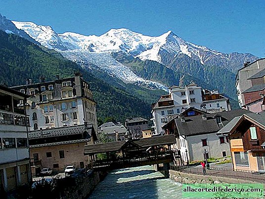
The name of this anomaly is El Nino, which is Spanish for "baby" or "boy." Despite such a harmless name, "baby" is able to change the region beyond recognition. Under normal conditions, a strong cold Peruvian current flows from south to north along the west coast of South America. This current, carrying its waters from arctic latitudes, is rich in oxygen, and therefore provides an abundance of marine fauna along the entire coast. Following the abundance of plankton and fish, one can observe a high number of marine predators and birds, which are attracted by the abundance of prey. The same course provides the arid climate of the western coast of South America, and the famous Atacama Desert is largely his work.

But once every few years, the temperature of the water in the zone of the cold Peruvian current rises. At first glance, a slight warming, only 0.5 ºС, can lead to climate change, and more significant warming provokes terrible disasters. According to most experts, it is the temperature rise of the Peruvian current that is the main condition for the emergence of El Nino. Trade winds, winds constantly blowing in the tropics of the World Ocean due to the rotation of the Earth around its axis, blow from the eastern part of the Pacific Ocean to the west. But during the period of the onset of El Nino, or the Southern Oscillation, as scientists also call this process, the trade winds weaken. In some cases, the trade winds can completely stop blowing or even change their direction and blow from west to east. With this anomaly, a sharp change in climate occurs along the western coast of South America, which affects North America, even India and Indonesia. In the usually arid territories of Peru, Chile and Ecuador, torrential rains fall, which can lead to severe flooding and cause serious economic damage. Weter periods than normal climate are also observed in the Western United States and Mexico. But in Australia, Indonesia, and throughout the region of Southeast Asia, the absence of trade winds due to a change in their direction causes a long drought, which in turn negatively affects the agriculture of the region. In addition, an increase in temperature in the waters of the Peruvian current contributes to a decrease in the amount of oxygen and leads to the mass death of fish and marine fauna.

Scientists have been able to establish that similar processes sometimes occur on the territory of the Atlantic. A cold current flows along the western coast of Africa, the increase in temperature of which also causes climatic anomalies in the region.
Over the past 30 years, the strongest El Niño has been observed in 1997-1998 and has led to serious economic upheaval in regions affected by climate anomalies. Subsequent phenomena were observed in 2002-2003, as well as in 2015-2016. Despite the fact that this anomaly has been known since the end of the XVIII century, as well as to numerous studies carried out in connection with this process, scientists still have not been able to find out the cause of the periodic increase in temperature, and also to determine the period when El- Nino.

Watch the video: Sea surface height anomaly (May 2024).


-
Battle of african lions
Despite the fact that the most dangerous animals on safari are elephants, lions are perceived much worse. Huge, powerful animals whose muscles "shimmer" when walking. Leo does not hide his eyes; he looks directly into his eyes, and you understand that under other circumstances he could have become his prey. At first it was, to put it mildly, restless from such views, but when we saw that the lions were doing their own thing and did not pay any attention to us, it became easier. ... -

-
-